Lake Ménarik
General Information
- Property covers 5,653 hectares (110 claims) and is 100% held by Harfang (33F06); 2% NSR Osisko Gold Royalties on most claims
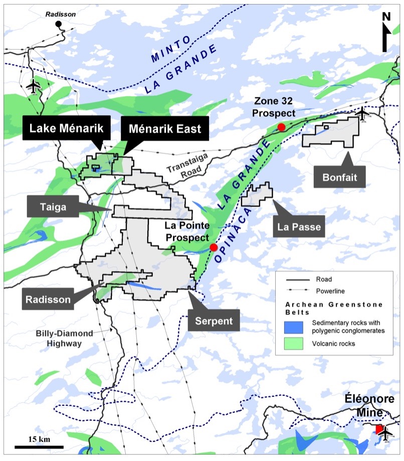
- Located 5 km east of the Billy-Diamond road, 30 km southeast of the La Grande airport; 45 km south of Radisson; 2 powerlines transect the mining claims
- Easily accessible by ATV, boat or air
- Located in the Archean La Grande Subprovince; includes volcano-sedimentary rocks (Yasinski Group), intermediate to felsic intrusive rocks (Duncan Intrusions), sedimentary rocks with a Timiskaming-type conglomerate (Ekomiak Formation), and ultramafic and mafic lamprophyres
- Greenschist and amphibolite facies (metamorphic contrast across the Lac Menarik Fault)
- High-grade gold commonly associated with quartz-carbonate veins hosted in several types of lithologies: porphyritic monzonitic suite, mafic volcanics, gabbro, wacke, arenite, iron formation, polymictic conglomerate
- Complex alterations: chlorite, hematite, quartz, calcite, ankerite, sericite, albite, K-feldspar
- Disseminated sulphides: commonly pyrite, local chalcopyrite, and rare pyrrhotite and arsenopyrite
- Only 17 drillholes done in 2000 in a small part of the property
Maps
Highlights
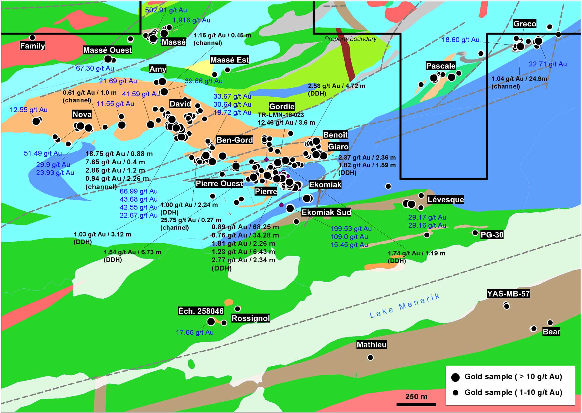
- More than 500 surficial sampling sites grade between 1 and 1,918 g/t Au
- Mineralization characterized by high-grade gold veins (with visible gold) and low gold tenors over large widths; some of the best results include:
- 0.89 g/t Au over 68.25 m (DDH) [Pierre showing]
- 12.46 g/t Au and 25.5 g/t Ag over 3.60 m (channel) [Gordie showing]
- 18.75 g/t Au, 31.1 g/t Ag and 0.41% Cu over 0.88 m (channel) [David showing]
- 110.83 g/t Au (grab) and 1.06 g/t Au over 4.51 m (DDH) [Ekomiak showing]
- 1,918 g/t Au (grab) [Massé showing]
- 1.04 g/t Au over 24.9 m (channel) [Greco showing]
- Two possible metallogenic models: orogenic gold and monzonite-associated gold models
- Geological and metallogenic contexts sharing strong similarities with Malartic, Young Davidson, Beattie and Douay gold deposits
Upcoming Exploration Programs
- Additional prospecting and detailed mapping concomitant to a geological compilation of the historical data
- A drilling campaign anticipated during winter 2023
Images
Figure 2
Sericite and quartz alterations with pyrite overprinting the hematitized monzonite at the Pierre showing (5.83 g/t Au over 0.28 m, DDH1404-03)
Figure 3
Intense sericite alteration and quartz veining overprinting the hematitized monzonite at the Pierre showing (3.45 g/t Au over 0.35 m, DDH1404-03)


