Ménarik East
General Information
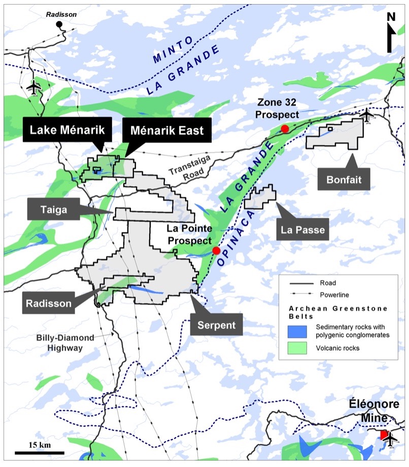
- Property covers 3,289 hectares (64 claims) and is 100% held by Harfang (33F06); no NSR
- Located 12 km east of the Billy-Diamond road and 7 km north of the Transtaiga road; 35 km southeast of the La Grande airport; 50 km southeast of Radisson; powerlines near mining claims
- Easily accessible by ATV, boat or air
- Located in the Archean La Grande Subprovince; mainly intermediate to felsic intrusive rocks (Duncan Intrusions and/or Langelier Complex) and the Menarik ultramafic-mafic layered Complex, minor volcano-sedimentary assemblage (Yasinski Group)
- Over 200 drillholes (>36,000 m); excellent database
- Polymetallic showings and drillhole intervals with significant potential for magmatic chromitites (Cr-PGE) and massive sulphides (Ni-Cu-PGE), and orogenic gold deposits
Maps
Highlights
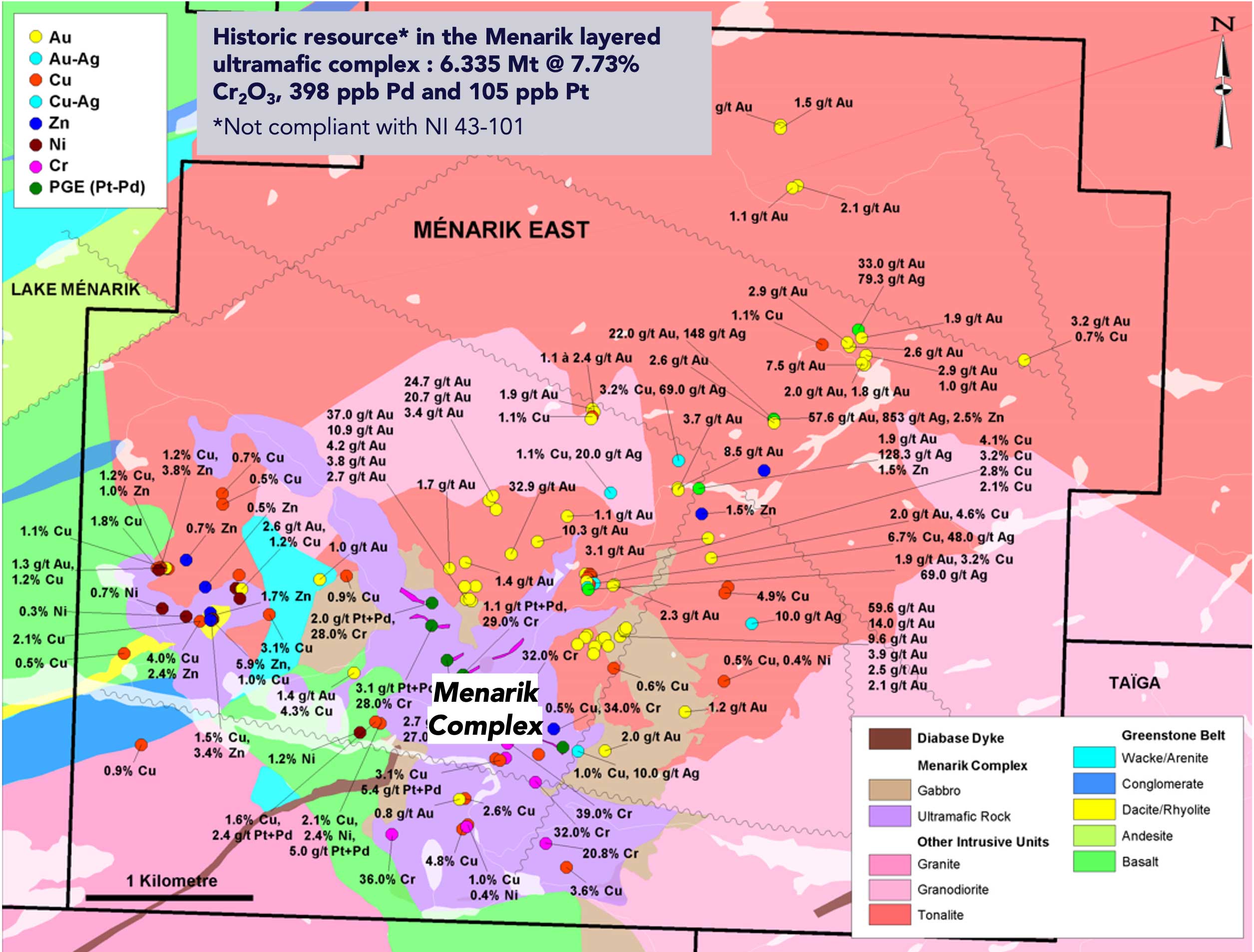
- Historical resources in the Menarik Complex: 6.34 Mt @ 7.73% Cr2O3, 398 ppb Pd and 105 ppb Pt; and 1.06 Mt @ 0.38% Ni and 0.15% Cu (resources non-compliant with NI 43-101)
- Widespread gold and polymetallic mineralization (As, Cu, Zn, Pb, Ag) in shear zones between gabbroic dykes and tonalite; commonly associated with silica and fuchsite alteration (listwanite-associated orogenic gold)
- High-grade gold and silver-rich samples with significant base metal values; up to 57.6 g/t Au, 858 g/t Ag, 2.49% Zn, 2.24% Pb and 18.04% As in a grab sample, and up to 5.58% Cu in another sample
- Regional and most probably deep-seated structural lineaments that may have acted as conduits allowing upward migration of ultramafic-mafic magmas (Menarik Complex and lamprophyres) and hydrothermal fluids; these fluids mobilized gold and other metals from the crust and later precipitated these elements into chemically favourable lithologies; ideal setting for structurally-controlled gold and polymetallic mineralization
Upcoming Exploration Programs
- Additional prospecting and detailed mapping concomitant to a geological compilation of the historical data
- A drilling campaign could be deployed during winter 2023
